5 case studies
Studio projects
These case studies come from studio coursework. Each one is a student design proposal — not built work — and each follows the same structure: the site and question, what the analysis revealed, how the design developed and what I took from it.
Group projects are labeled, and the focus is on process and reasoning rather than polished renderings. Related articles are linked throughout.
- Context
- Studio coursework · individual
- Site
- Large surface parking lot, commercial edge
- Focus
- Stormwater
- Grading
- Planting zones
- Pedestrian routes
Parking lot to planted watershed
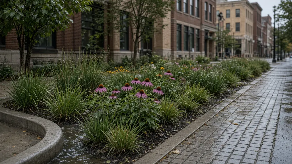
A proposal to retrofit a large, flat parking lot with a connected series of bioswales and planted islands that slow, filter and soak in runoff while improving the walk from car to door.
The site and the question
The site was a large surface lot that drained entirely to a few inlets at its low edge. It was hot in summer, windy in winter and unpleasant to walk across. The brief asked how a parking lot could manage more of its own stormwater without losing its function.
What the analysis showed
Mapping drainage areas showed that most of the lot sloped gently in one direction, which made a chain of swales along existing grade lines possible. Desire-line observation showed people cutting diagonally between rows, which suggested where a planted walking route could go. Notes on snow showed where plows already piled it.
Design development
Early versions scattered rain gardens wherever there was space. Checking them against grades showed several would never receive water. The final proposal uses fewer, longer bioswales aligned with the slope, connected by overflow so each one hands off to the next, and a planted walkway that follows the observed diagonal. Planting is zoned for wet swale bottoms, average side slopes and tough, salt-tolerant edges near inlets.
Details that mattered
Curb cuts at true low points, stone aprons to slow inflow, small sediment forebays that are easy to clean and designated snow storage areas away from inlets. The approach is explained further in rain gardens and bioswales in Lincoln.
What I took from it
- Grades decide where stormwater features can go; draw flow arrows before drawing gardens.
- A few well-placed, connected swales beat many scattered ones.
- Maintenance access and snow storage belong in the first concept, not the last.
- Context
- Studio coursework · group of three (my role: analysis, planting, sections)
- Site
- Urban creek corridor with an existing trail
- Focus
- Floodplain
- Riparian planting
- Trail alignment
- Access to water
Room for the creek
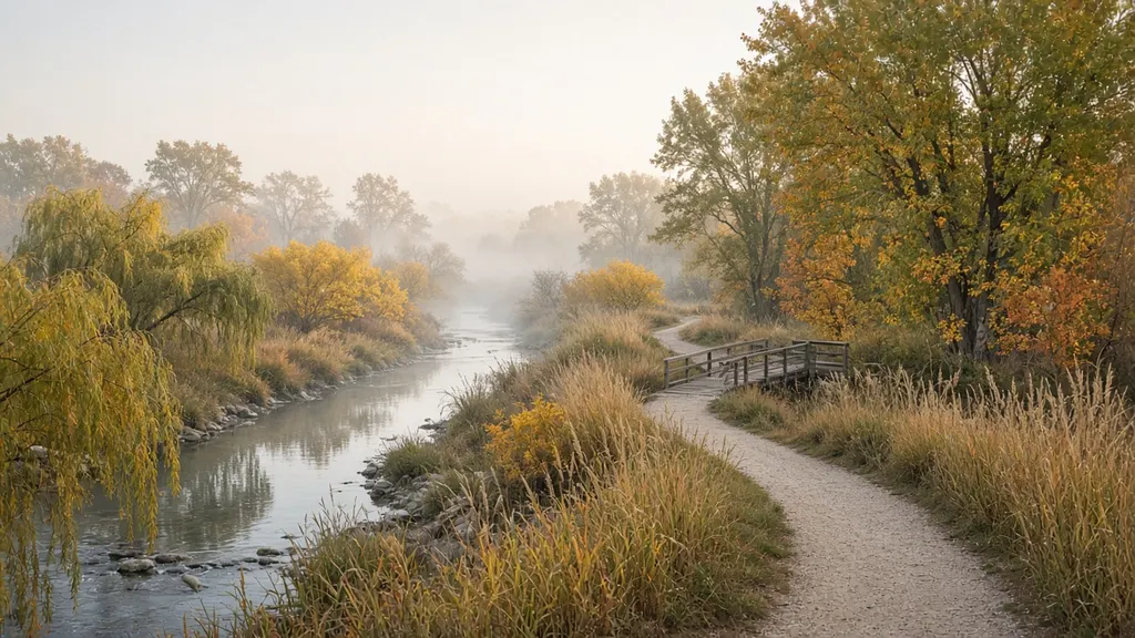
A corridor proposal that sets the trail back from an eroding bank, lays back slopes where space allows, zones riparian planting from wet edge to upland and concentrates access to the water at two durable landings.
The site and the question
The stretch of creek had steep, eroding banks, an existing trail that flooded after storms and several informal paths down to the water that were widening each year. The question was how to make the corridor more stable and more enjoyable at the same time.
What the analysis showed
Debris lines and flattened vegetation showed how far small floods reached. Informal paths clustered at a few spots where the bank was lower — clear evidence of where people wanted to reach the water. Bank conditions varied a lot along the reach, which ruled out a single treatment.
Design development
We tested three trail alignments. The final one moves the main trail to the edge of the floodplain, keeps one existing crossing and adds two landings at the most stable access points. Bank treatments vary by condition: laid-back planted slopes where space allowed and a hybrid of rock toe and planting where it did not. My part focused on riparian planting zones and the sections that explain them.
Limits we acknowledged
Channel and bank work on a real project would be engineered and permitted with specialists. We presented the proposal as a design concept and noted those steps. The broader reasoning is in designing trails and edges along Lincoln's creeks.
What I took from it
- Informal paths are data: they show where access should be designed.
- Giving water room is usually the most stable move.
- Sections explain riparian zones better than plans.
- Context
- Studio coursework · individual
- Site
- Small downtown plaza between mid-rise buildings
- Focus
- Winter sun
- Wind shelter
- Snow storage
- Materials
A plaza for January
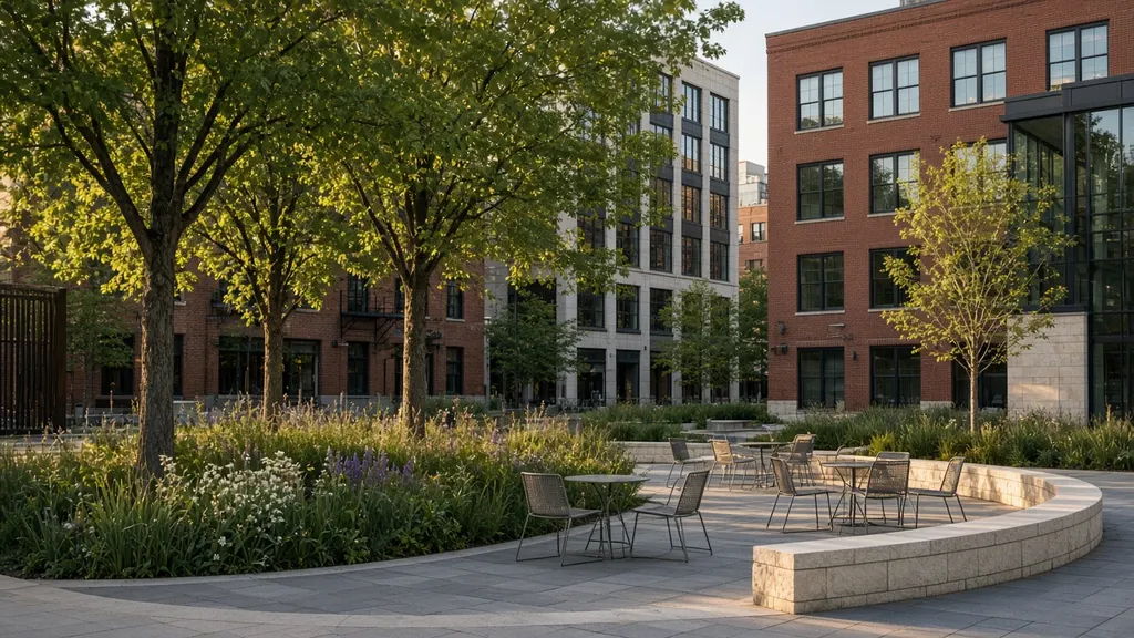
A redesign of a small, windy plaza that puts seating in winter sun, shelters it with planting and low walls, plans snow storage and uses grasses and evergreens to keep the space alive from November to March.
The site and the question
The plaza was busy at lunch in summer and nearly empty the rest of the year. It was shaded for much of the winter day and funneled wind between buildings. The question: what would it take for this space to be pleasant on a bright, cold day?
What the analysis showed
Sun studies for different months showed that only the north edge received meaningful winter sun. Wind observations confirmed a gusty corridor from the northwest. People crossed diagonally regardless of the existing walks.
Design development
Seating moved to the north edge, facing south, with wood seats instead of metal. A band of evergreen and grass planting and a low wall break the wind at seat height. The diagonal became the main path. Deciduous trees on the south side shade the seats in summer and let low winter sun through. Snow storage areas double as planted swales.
Planting and light
Grasses and seed heads stay standing until late winter; a crisp edge shows the planting is intentional. Warm, low-glare lighting marks the path and highlights the trees after dark. The principles are collected in designing public space for Nebraska winters.
What I took from it
- Winter sun studies changed the whole layout.
- Wind shelter at seat height matters more than overall enclosure.
- Every paved edge needs a plan for snow.
- Context
- Studio research coursework · individual
- Site
- Small test plots on a campus-style open space
- Focus
- Prairie planting
- Establishment
- Observation
- Maintenance
Seed, plugs or both?
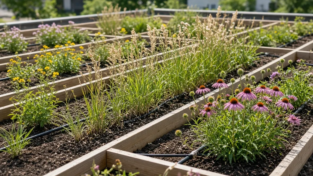
A study comparing three ways of establishing prairie-inspired plantings — seed, plugs and a seeded matrix with plugs — documented with photos and notes across a growing season.
The question
Prairie-inspired plantings are often recommended, but the choice between seed and plugs is usually made on budget alone. I wanted to understand what each approach looks like on the ground during establishment, and what that means for design and maintenance.
Method
Three small plots used the same species list: one seeded, one planted with plugs and one with a seeded grass matrix and plugs of key flowering species. I photographed each plot on a regular schedule and kept notes on coverage, weeds and maintenance time. It was a small, informal study — useful for observation, not for general conclusions.
What I observed
The plug plot looked finished soonest and was easiest to read as intentional. The seeded plot was slow and weedy early, as expected, and needed high mowing. The mixed plot sat in between and looked the most like a cohesive community by the end of the season. These are observations from one season on one site.
How it changed my design work
I now propose plugs near entries and walks, seed for large low-visibility areas and mixed approaches in between, with the maintenance plan written alongside. More in tallgrass prairie as a design reference.
What I took from it
- Establishment is a design phase, not an afterthought.
- Visible areas need a faster, more legible start.
- Small, careful observation teaches more than generalizations.
- Context
- Studio coursework · individual
- Site
- Residential street with wide parkways
- Focus
- Streetscape
- Stormwater cells
- Cues to care
- Neighbors
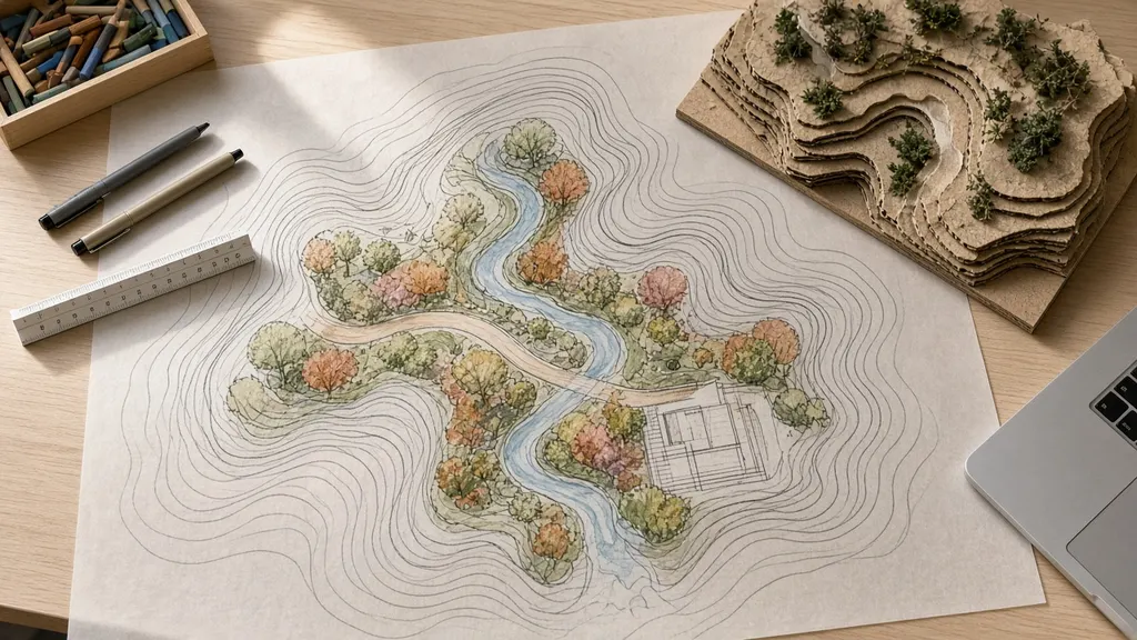
A green street for a residential block
A proposal to turn the parkway strips of one residential block into a sequence of planted stormwater cells and pollinator plantings, with clear edges and gaps for car doors, mail and snow.
The site and the question
The block had wide turf parkways, a gentle slope and runoff running along the gutter to a single inlet. The question was whether the parkways could manage some street runoff and add planting without causing problems for residents.
What the analysis showed
Observation showed where people parked, crossed and put out bins, and where driveways interrupted the parkway. Those patterns set the rhythm: planted cells between driveways, with turf or paved gaps where people step out of cars.
Design development
Each cell takes water through a curb cut and overflows back to the gutter. Planting uses tough prairie species on the edges and moisture-tolerant species in cell bottoms, with a mown or stone edge as a clear cue to care. Snow from the street is stored on the gaps rather than the cells.
What I would do next
A real version would need engineering review and conversations with residents. I would test a pilot on one or two parkways first. The reasoning builds on rain gardens and bioswales and site analysis.
What I took from it
- Everyday patterns — parking, bins, mail — set the design rhythm.
- Clean edges make looser planting acceptable on a residential street.
- Pilots are a good way to test ideas with neighbors.
About these
About these projects
01Are these built projects?
No. They are studio proposals developed for coursework and reviews.
02Were any of these group projects?
One was a group of three; it is labeled with my role. The others were individual.
03Where can I read more about the ideas behind them?
Each project links to a related long-form article. The full list is on the articles page.
Read the writing
Longer articles on the questions these projects raised — soils, water, plants and process.